Start/Finish: Westgate
Distance: 11.5 miles
Tine Taken: 7 hours
Companion(s): None (first solo walk - woohoo!)
Route Map:

Well, the weekend weather had been particularly inclement for walking and, added to that, my weekend had been filled with grand-child care and activities. So, when I saw the weather forecast on Sunday evening, which suggested a very promising weather day for Monday, I decided that a last minute day's holiday from work would be in order. Luckily, I had no appointments in my diary and the understanding boss sympathises with my dilemma on when to take holiday :-)
So, I packed my rucksack and set off on the drive to Westgate at about 11.30am. I took a very scenic route over the moorland between Edmundbyers and Stanhope - very steep drop down Crawleyside - but so scenic I even considered stopping to take a few photos. Maybe next time though, as I had already had a late start to the day!
Upon reaching Westgate, I followed a signpost for a car park. However, this proved to be a fruitless task as it seemed to lead me down a country lane which was only wide enough for one car and the only place that I thought could possibly be a car park seemed to be in someone's garden! Hmmm...what can one do but drive around the country lanes a bit and try to find a suitable parking space? :-)
Eventually, after a few extra miles of driving around Westgate and Daddry Shield (? I'll check up on this place name but I think it's correct), I decide that the best option for parking is a large layby, opposite a caravan site and just a few hundred yards from the shop/post office in Westgate.
Anyway, at long last, I was parked up and began to get 'booted up' and ready for the start of the walk - my first walk on my own! It felt very strange to say the least but, my thoughts at the time were to do a shortened version of the originally planned walk as I was having a late start, the forecast was for rain later in the day and this was to be my first solo adventure. Why didn't I stick to my original plan?!!
I set off from the car and walked just a little way along the street before turning left up onto the Rookhope road. From here, I joined a footpath following Middlehope Burn, through Slit Wood. This is an absolutely lovely path which took me a long time to complete as I kept stopping to take photographs. Apologies now for the amount of them :-)

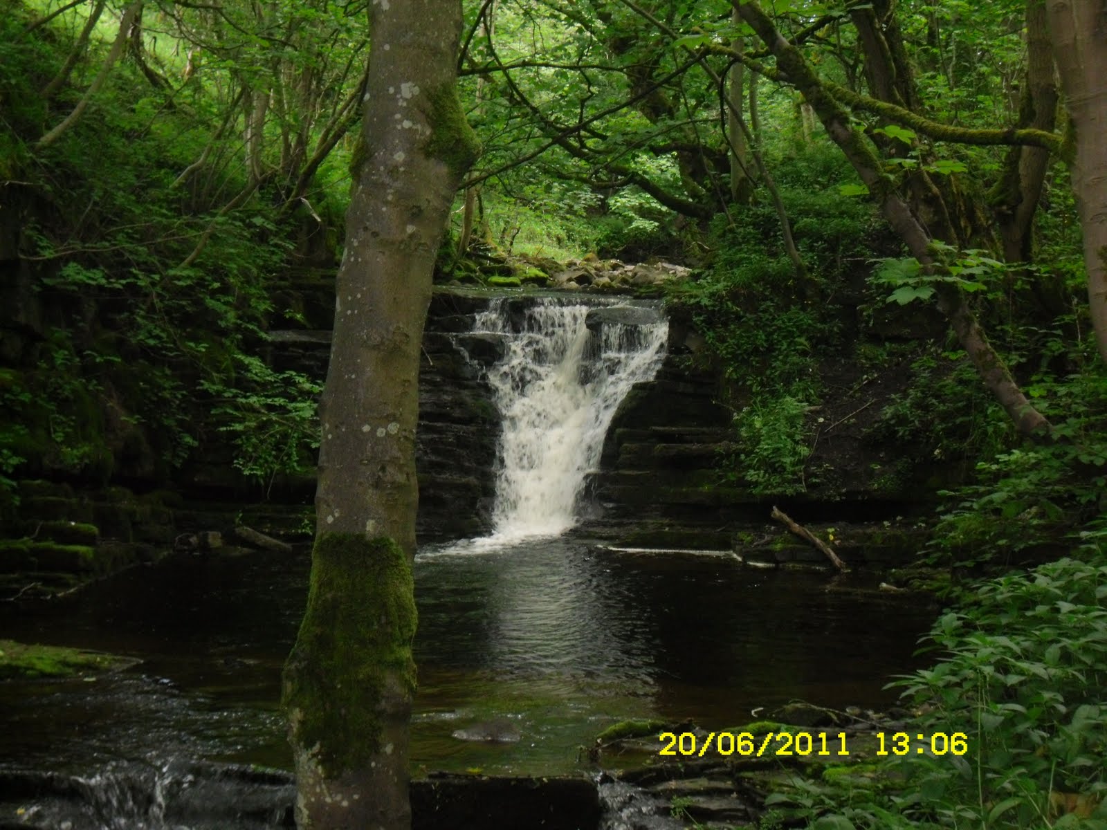


As you might be able to tell, I love waterfalls!
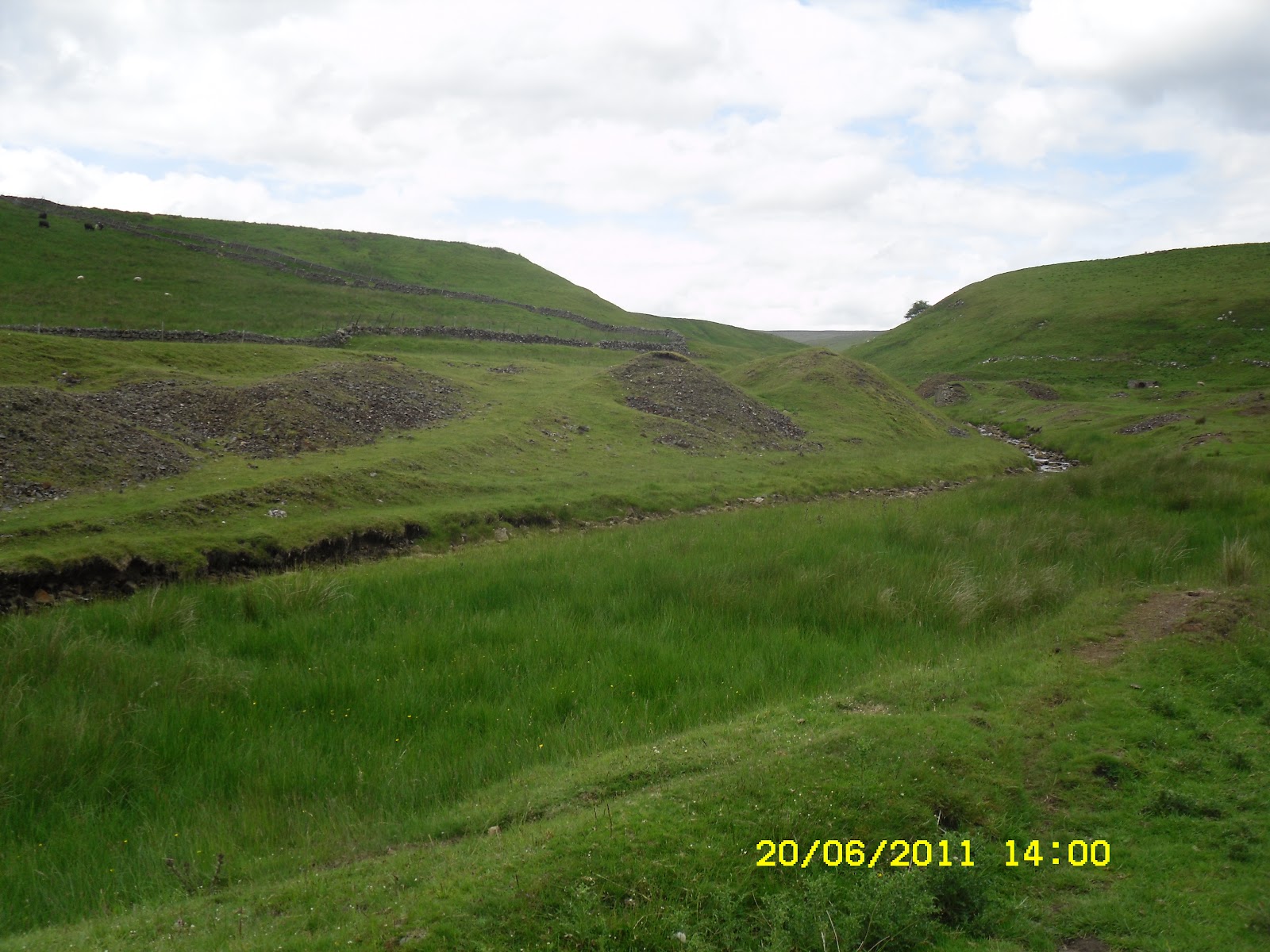
Continuing up Middlehope Burn, this seems to be an area for wildlife and wild flowers but eventually, you come across some old mine ruins. There is obviously still some work going on in this area but, a lot of the repair work has already been done I think.


Carrying on, following the path, I keep following the burn (yet more pics - sorry!)

Just before I took the next photo, a squirrel darted across the path in front of me (a grey one, unfortunately, but still very nice to see!) I was guessing it was still hiding in the tree somewhere.

Keep on following the path...

and you come across this commemorative seat

And the view from the seat:

Leaving the woods soon:

some more derelict buildings - mine sites or dwellings? But, back to the walk....


Now what on earth is this?


Not sure what species the wildflower above is and it's not a very good picture of it but I did see quite a few of these amongst the wild pansies.
At this point, my route left Middlehope Burn as I turned right and followed a track up and out of the valley.


Looking back down the track and a view from the top of the short climb:


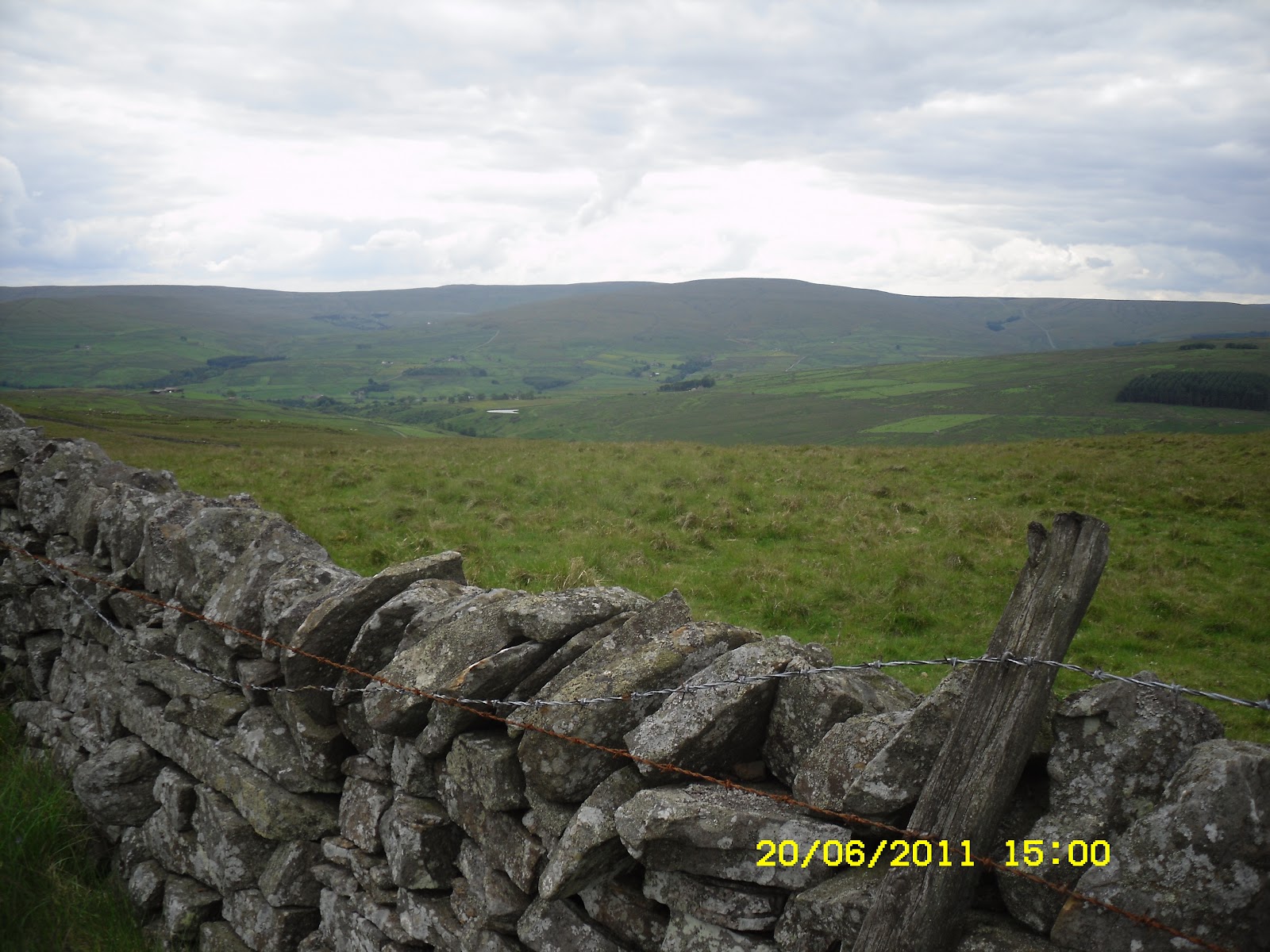
I turned right to follow the track up to a minor road, where I turned right to head up towards Scarsike Head


...and a view or two from the walk up the road. looking back to Middlehope Burn


Having now reached the crossroads beside Scarsike Head, I turn right to head down a road heading back down to Westgate.


This was decision time. Do I just head down the road all the way back to Westgate and do the short version of the route or do I carry on with the long version and walk the entire route as per the original plan for the area? Well, the weather was still good, I was enjoying myself and I thought if I stopped taking so many pics, I could probably make it back to the car on the long version of the route by about 6.30pm at the latest. Oh how wrong I was lol! :-)
So, decision made, I took the left turn from this road to join the Red Road path leading onto Smailsburn Common and heading towards Rookhope. This was where the fun started and you may notice that the camera didn't venture out at very frequent intervals from this point forward! However, the camera's owner had now embarked on the solo adventure part of the walk!!
I soon came across the first alert that this part of the walk was possibly not going to as simple to navigate as it could have been.

I was now on open moorland and it was quite difficult to see the path (is it a path or is it just a sheep trail?). The fallen waymarker provided a little bit of comfort but did little to convince me that I was heading the right direction.


And the next waymarker, was of little use either...


But finally, I could see a fence and what looked to be a stile and another waymarker.

I crossed this stile, and crossed the field to another fence. The fence had a waymarker but no stile! A few bits lay on the ground but nothing else. I checked the route guide and realised that it said, if you come to a fence, turn left and if you come to wall, turn right. So I turned left and followed the fence to reach a sort of crossroads of fences and walls with a couple of gates thrown in. No stiles, gates locked or tied and wedged shut so, no option but to climb over. Oh joy!
Anyway, the route guide said to simply follow the wall downhill from here all the way to Rookhope, passing a small reservoir on the way. Sounds simple enough but, oh no, never underestimate the problems you can have simply trying to follow a wall downhill! 'Which side of the wall should I be on?', 'Where on earth has the path gone?', 'Am I trespassing?', 'If I'm on a path, why hasn't this fence got a stile over it?' Oh my lord, this route took forever and a day it seemed as I climbed over fences, walls, trotted through boggy patches, climbed over barbed wire and, dear knows how many 'panic moments' I had to overcome! My map reading and GPS usage skills definitely got a good workout and I can fairly confidently say, that I knew I was in the right place, heading in the right direction but just couldn't find the bloomin path. I did take a few pics but nothing very exciting....


Anyway, I eventually entered Rookhope (note the time!)..


and decided I deserved a little rest at the Rookhope Inn..

Having survived the walk over Smailsburn Common, I decided that I had probably done enough for one day and I tried to phone a taxi from here to take me back to Westgate but, all I got was an answerphone message. The bar person said I could try again later but, having quenched my thirst, I decided it was probably going to be quicker to walk back to Westgate than it would be to wait for the 'lone taxi driver'! The route back to Westgate was mainly on the Weardale Way and I mistakenly assumed this would mean the paths would be easily discernible and there would be no obstructions. Hmmm....I think she I should stop making assumptions!
Anyway, I headed out on the final leg of the walk - even less photos now as I was just determined to get back to the car in as short a time as possible - and expecting a fairly simple route back. This would have been true had it not been for a few locked gates, disintegrated stiles and one point when I thought there was just no way across a huge (huge might be a slight exaggeration but I'd had just about enough at this point!) abyss! :-) I did take a couple of photos....


and eventually, Westgate came into view....

You would think it was simple from here...and it was, apart from the fact that. I was now heading down a road with such a deep descent that I wished I almost had to zig-zag my way down in order to reduce the incline a bit :-)
Regardless of all of the above problems and difficulties, I thoroughly enjoyed my first solo walk and feel as though I am comfortable with my abilities to overcome adversities. Luckily, the weather stayed on my side for the whole of the walk and....I'm sure I'm now a lot fitter for having climbed all of the gates and walls, etc. Muscles I didn't even know I had have been complaining a little in the last couple of days but nowhere near as much as I expected! :-)
wow what a comprehensive report ! don't be sorry at the amount of photo's it's a virtual tour, some times the Blogs harder work than the actual walk
ReplyDeletethanks for your time Danny
NIce one Y! IM SURE you can do Striding Edge now :)
ReplyDeleteAJ off forum