Start/Finish: Parking area near Carey Burn Bridge
Distance: 11 miles
Time Taken: 6.5 hours
Companion(s): None - walked solo again!
Route Map:

Having been 'poorly bad' all of the previous week with the flu, I hadn't ventured out at the weekend. I was, however, hoping to walk with my usual walking partner today and had already scheduled the day off work. Unfortunately though, the dreaded news had already arrived letting me know that my walking partner is broken and won't be able to come out to play for quite some time :-( So, once the expletives had been muttered and I had convinced myself that temporarily being walking partnerless wasn't the end of the world, I decided that I would try another walk on my own. I had a quick trawl through my HUGE pile of walk route printouts and Monday evening saw me hastily planning a suitable route for my solo adventure and, with a little help from a friend (thank you!), the decision was made to pay another visit to one of my favourite areas - the Cheviot Hills.
The route we had planned was to be a combination of new and old as some of the paths had been walked by me on previous occasions but others would take me into parts I hadn't yet ventured into. I was hopeful that my familiarity with the area would allow me to stay well within my comfort zone though - as you may already know, walking solo is not entirely a preferred option of mine!
Well, on with the walk.....
As is usual when venturing out on my own, I hummed and hahhed a bit whilst preparing to go out for the day so I set out quite a bit later than I usually would. Eventually though, I threw my gear into the car and took to the road. It was a beautiful, bright and sunny morning and I couldn't wait to see my beloved Cheviot Hills again and so, it was with a happy smile on my face that I duly arrived at the parking spot and got ready to begin my adventure.
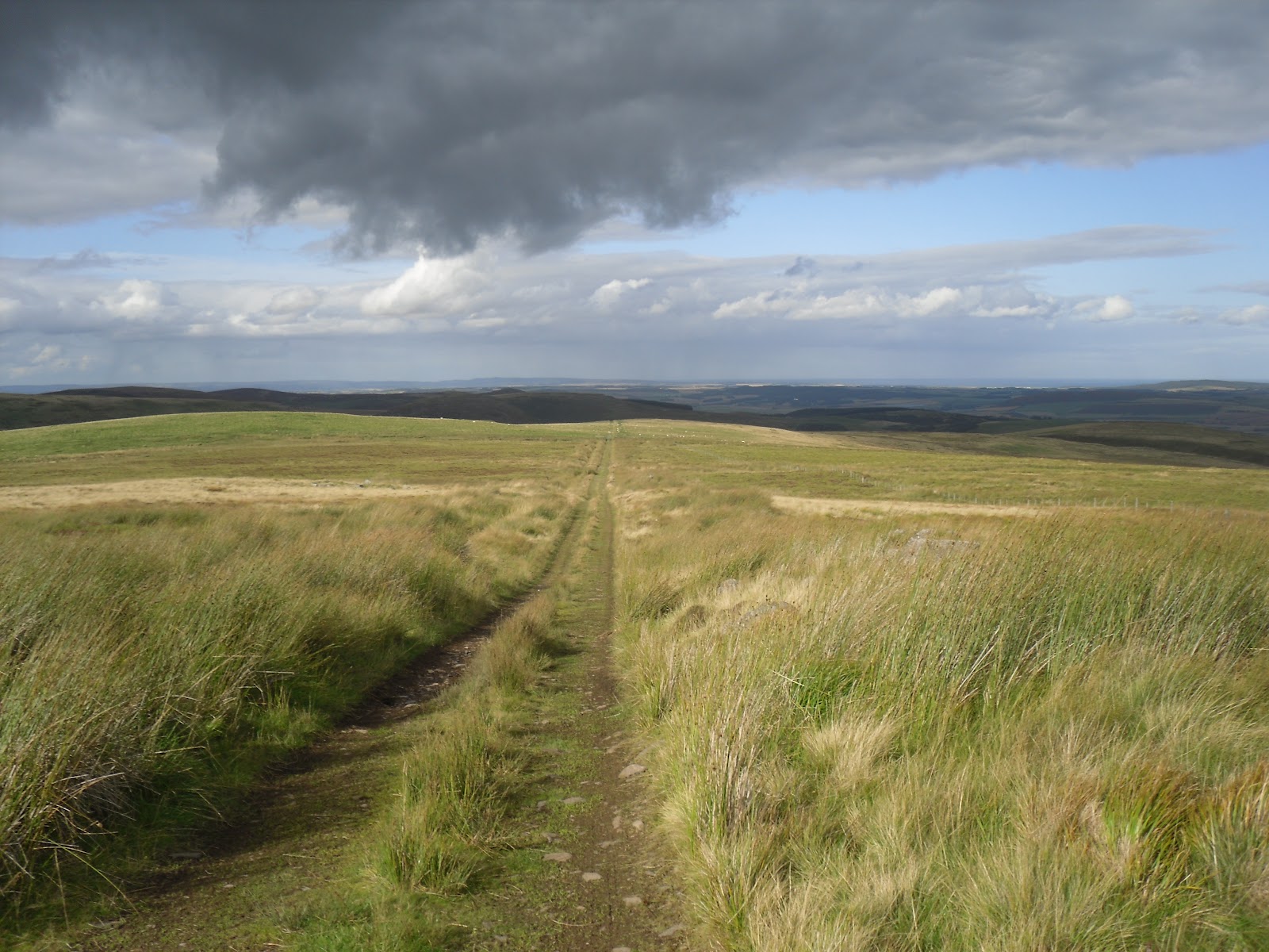
11.15am and I took a few photos from the spot where I parked the car...
Looking up at Skirl Naked...


The way ahead....Carey Burn Bridge with Snear Hill in view...

I wasn't going up the hill though....I took the path that followed Carey Burn through the valley between Snear Hill and Hart Heugh...


...and, lo and behold, what should appear as I come around the corner....a lovely little waterfall :-) Wonderful!!!


Eventually, I dragged myself away and reluctantly continued with the walk. To be honest, I could have just spent the rest of the day sat beside the waterfall, enjoying the lovely weather and the beautiful scenery but I decided that would be a bit of a wimp out saying as this was supposed to be a walk and not a picnic :-)
But this bit was a bit tricky....a touch of low level scrambling was called for lol....


I made it across safely though and continued along the path. At this point, I could hear another waterfall but, sadly, you can't see anything....

Still enjoying the scenery along the way...


Looking back along Carey Burn with Steely Crag on the right..

The point where Hazelly Burn meets Carey Burn...

Heading towards the bridge to cross the Burn...

Hmmm....a bit of an obstruction here :-)


Crossing the bridge....


Then looking back as I head uphill...

...and my next destination, Broadstruther, comes into view....


Looking back again...

As I walk along towards Broadstruther, I can hear the military firing from somewhere in the distance and I begin to wonder if I'm going to get shot at today! :-)


Having now crossed Broadstruthers Burn, I had a little rest break and simply admired the scenery again....


Continuing on my way, I headed up past the house at Broadstruther and managed to out-manoeuvre the military who continued with their firing exercise up on Great Moor somewhere.


With the summit of Hedgehope Hill peeping into view in the distance, I followed the bridlepath over Rushy Gair, leaving the military behind.


Looking up at Cold Law...

...and Hawsen Crags...


Heading down following Hawsen Burn on my left, with Langlee Crags in the distance ahead of me...


Approaching the footbridge crossing at Harthope Burn looking at the steep climb ahead up towards Housey Crags just out of shot on the right although, I will veer off to the left to take the path in front of Langlee Crags.....


Ah...there's Housey Crags...

and there's Langlee Crags...

Now on my way up the hill, looking back at the route that brought me here..

Looking at the Cheviot...

Looking up at Housey Crags as I get nearer the top of the climb...

Made it as high as I need to go....now heading towards Langlee Crags...

Looking back again....

I was over there earlier...

Langlee Crags getting closer...

A nice spot for a coffee break???....

And now we have to head back down again....quite a nice, gentle descent this one...

Looking back at the Crags again....

Nasty clouds approaching from behind me over Hedgehope Hill and the Cheviot...

Looks brighter this way though....

Heading up and over Brands Hill admiring the views....


Then heading down towards Middleton Old Town where the path would have taken me straight through a field full of viscious looking cattle.....but I avoided that by trespassing my way through some other fields I think :-)
Looking back at Middleton Old Town and the viscious cattle...

It was at this point of the walk that I began to feel a little anxious and lonely - I think I was beginning to get tired, time was getting on, and my anxiety about the viscious cattle had obviously taken it's toll. So I dithered about a bit here, talking out loud to myself, having conversations with a non-existent walking partner - calling them names for sending me out on a route with a field full of viscious cattle to deal with - all whilst trying to decide if I should continue with the planned route or take the detour path which would shorten the walk by a couple of miles but....which I didn't have plotted out on my GPS and I had no idea how clear the path would be.
I'm sure it would all have been hilarious to watch and I'm laughing at myself as I write this remembering how I first convinced myself to continue with the route as planned and heading off in that direction, only to return again 10 minutes later when I had convinced myself that I should take the detour - haha, I must have looked (and sounded!) like a right nutter :-) Oh, how pleased I am that there was no-one around to witness that episode lol :-)
Anyway, I was now following the path that would take me from Middleton Old Town, high above but, following the course of Coldgate Water to eventually get me back to Carey Burn Bridge. At first, the path was quite clear and easy to follow and I enjoyed the views along the way...


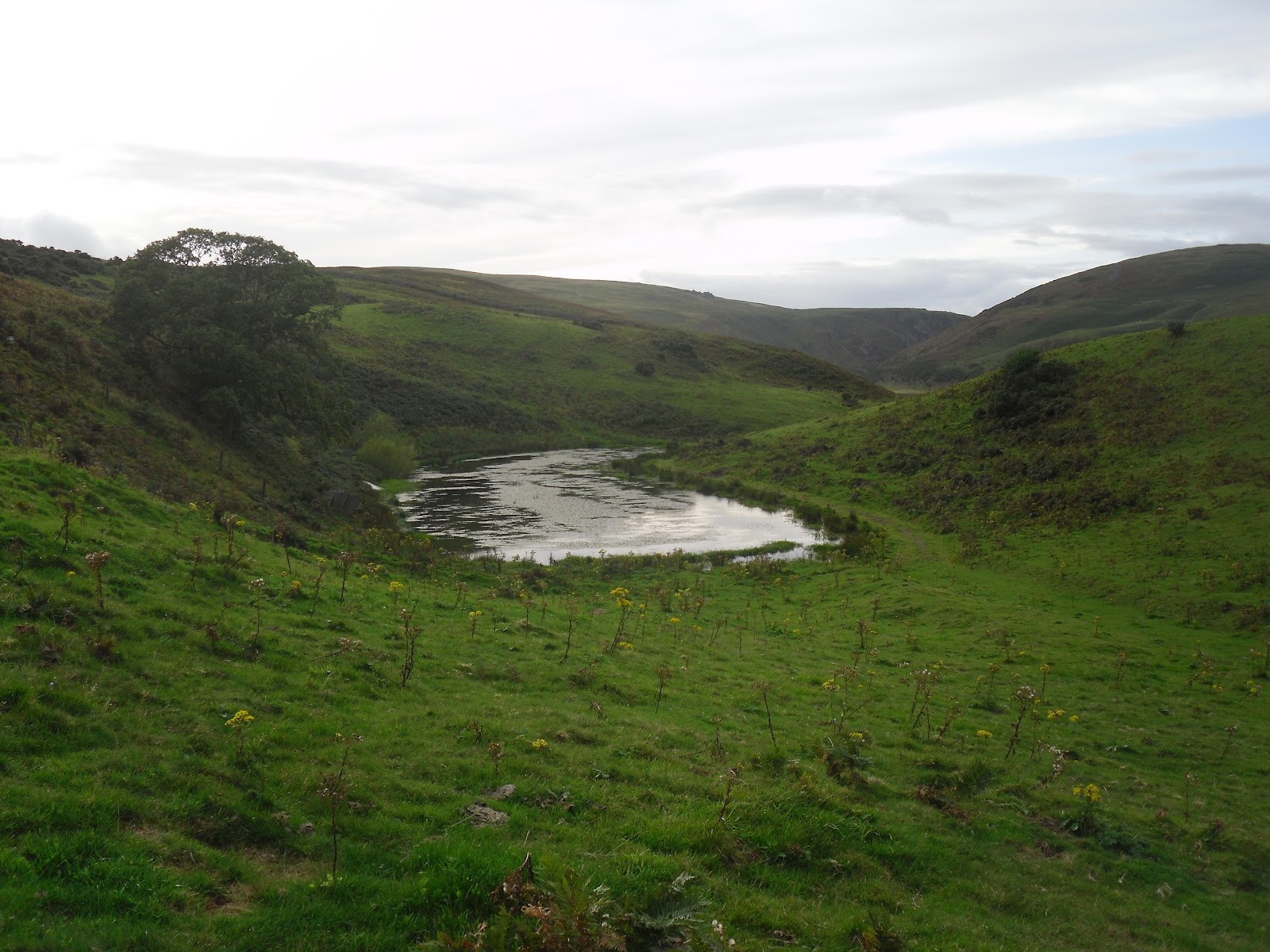
Then the path just seemed to disappear so I continued heading in the general direction I thought I needed to go, in the hope that the path would reappear again at some point soon. I felt much better when I turned a corner and this tarn came into view and I could see it on the map too!
It was whilst I was stood here that I received a message on my phone from Humperlumper saying he'd waited in all day for Sky to turn up to fix his internet and they'd never shown up. I replied with my sympathy and told him I was lost somewhere in the Cheviots. His response was 'ask a policeman'!!!! Haha - You have no idea how much I laughed at that......I had seen no more than 3 people all day and 2 of those had whizzed past me on bikes - lol :-)
Anyway, having regained my composure, I continued on my way and reunited myself with the correct path.....

....and finally made it to the bridge crossing the burn and back to my car at about 5.45 pm.


What a great day I had! The route was excellent and the weather had been great. Just a shame I didn't have a walking partner for the day to share it all with me :-(
Great Trip Report Yvonne, i like the fact you put many photos on each post, it shows the route better.
ReplyDeleteSee ya soon
Humperlumper